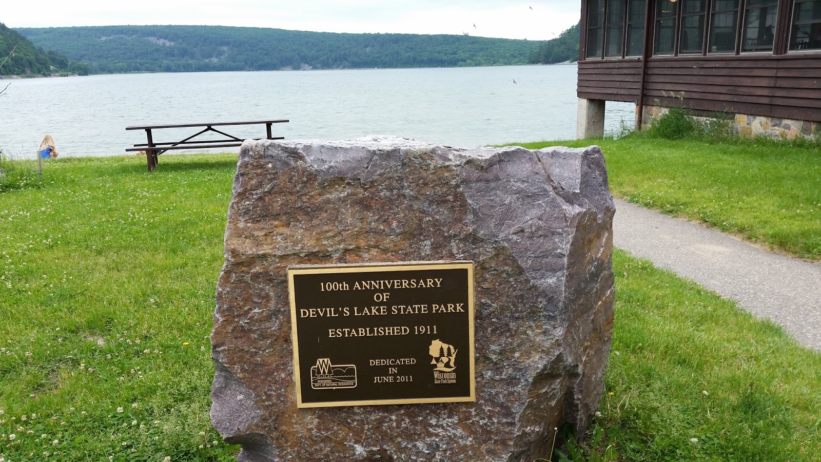
This trip would take us to Devil’s Lake State Park, Baraboo,
WI, Porcupine Mountain Wilderness State Park, Ontonagon, MI, Pictured Rock
National Lakeshore, Munising, MI, Tahquamenon (Phenomenon) State Park,
Paradise, MI, Muskegon S.P., Muskegon, MI
Click on Photo to enlarge
June 3rd
& 4th
We pulled out of our driveway around 7:30 a.m. and headed
out, making a quick stop at Starbuck’s for a Mocha and Green tea. The drive from Carmel, In to Baraboo, WI was
approximately 6-1/2 hours. We arrived at
Devil’s Lake SP mid-afternoon and set-up our campsite. Devil’s lake SP has always been a special
place, as I camped there during college days with my buddies and then again
with my wife over forty years ago. It
was great to be back and the place looked even more beautiful than we
remembered.

The 500 foot bluffs were formed about 1 billion years
ago. Before the bluffs existed, this
area was covered by an expansive blanket of quartz sand that accumulated under
the bottom of an ancient ocean. The
ocean covered the area between South Dakota and Lake Michigan. The pressure and weight of the accumulating
sand cemented the grains into sandstone.
Sometime between 1.4 and 1.6 billion years ago, the sandstone in this
area crumbled into a series of folds that became the bluffs we see today. During the folding of the rocks, the
sandstone was metamorphosed into the quartzite.
The last glacier that moved through the area stopped at Devil’s
Lake. The ridge at the North end is a
terminal moraine. The other terminal
moraine is at the South end of the lake.
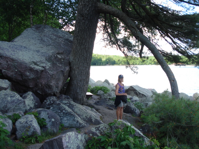
The boulder fields that surround Devil’s lake (called talus) were
created by freezing and thawing of the glaciers that sat here for about 8,000
years.


Indian Mound


Pink Quartzite

Susan and I hiked a couple of miles along the West shoreline
on a small paved trail among the large boulder field of quartzite. This was a great place to start our trip.
June 5th
– 6th


We headed out early for Porcupine Mountain Wilderness SP,
which borders Lake Superior to the North and the Ottawa National Forest to the
South. Somewhere between Stevens Point
and Rothchild Wisconsin we had a Bald Eagle fly across Hwy 51 in front of
us. Such a beautiful sight. We picked the rustic campground of Presque
Isle, with the waterfalls, the Presque Isle River, and a great view of Lake
Superior. The campground was about 50’
above the lake. Upon arrival we were
greeted by a swarm of black flies and mosquitos. The screen shelter was our saving grace. It was raining so we drove 25 miles up the
South Boundary Road to the park Wilderness Visitor Center. We drove back to our campground and hiked to
the first of the three falls, the Nawadaha Falls. The rangers said the river was the highest
that they had ever seen and was at a dangerous level. We hike the trail and crossed over the river
on a foot bridge and continued down to the river mouth and the beach. This was going to be the only place to safely
fly fish, and unfortunately with the rain, temperatures in the mid to high
40’s, and the half mile hike, the fly rod never left the camper.


The next day we lowered the roof and set-out for the town of
Ontonagon, MI to explore. We drove back
to the trail-head for the Summit Peak trail and hiked up to the top of the
mountain. The elevation is 1,958 feet
and is the 3rd highest peak in Michigan. The 50 foot observation tower makes it the
highest point in the state.

Summit Peak

Porcupine Mountain was a beautiful place and I’m sure had
the weather been more cooperative, we would have done a number of different
hikes and I would have gotten the opportunity to get some fishing in.
No comments:
Post a Comment